Reality Capture
What we see in reality can often be better understood in a digital environment. Using the latest construction technology, Messer can capture an object, building or site to bring accurate information into a virtual representation—ensuring decisions are based on real-world data rather than outdated plans and assumptions.

High-definition Laser Scanning
HD laser scanning is a non-contact, non-destructive way to measure a physical object's exact size and shape so it can be translated into a 3D digital representation. By creating these “point clouds” of data, Messer can capture the closest portrayal of reality in a digital format.
Use cases:
Existing conditions for BIM coordination
Floor topography
Structural as-builts
Architectural details
Sitework scans
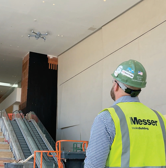
UAV/Drone Capabilities
Through UAV/drone technology, Messer can collect aerial data of project sites and combine it into one complete image or virtual model. It’s a safe, efficient and reliable way to gain a clearer understanding of site/building conditions.
Use cases:
- Site mapping
- As-built documentation
- Quality and warranty inspections
- Progress photos and site logistics
360 Degree Photography
Through a construction application called Structionsite, Messer can document project progress via 360 degree photos.
Use cases:
- Site documentation
- Video walks
- Model comparisons